If you do recieve copies could it not go on Marple website
That was always the intent Amazon.So, here now are maps made available yesterday plus a message that came with them.Note that apart from the boundary map they are draft, so subject to comments and change.There are images attached plus pdf links so that people can zoom in for more detail if they wish.---------------------------
Sorry for the delay in replying. The plan is currently a draft, so the maps are in draft form too.
The maps which we have available are:
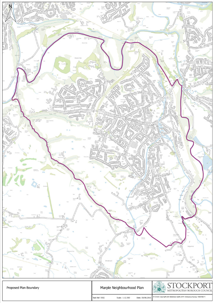
- Neighbourhood Plan Boundary (attached)
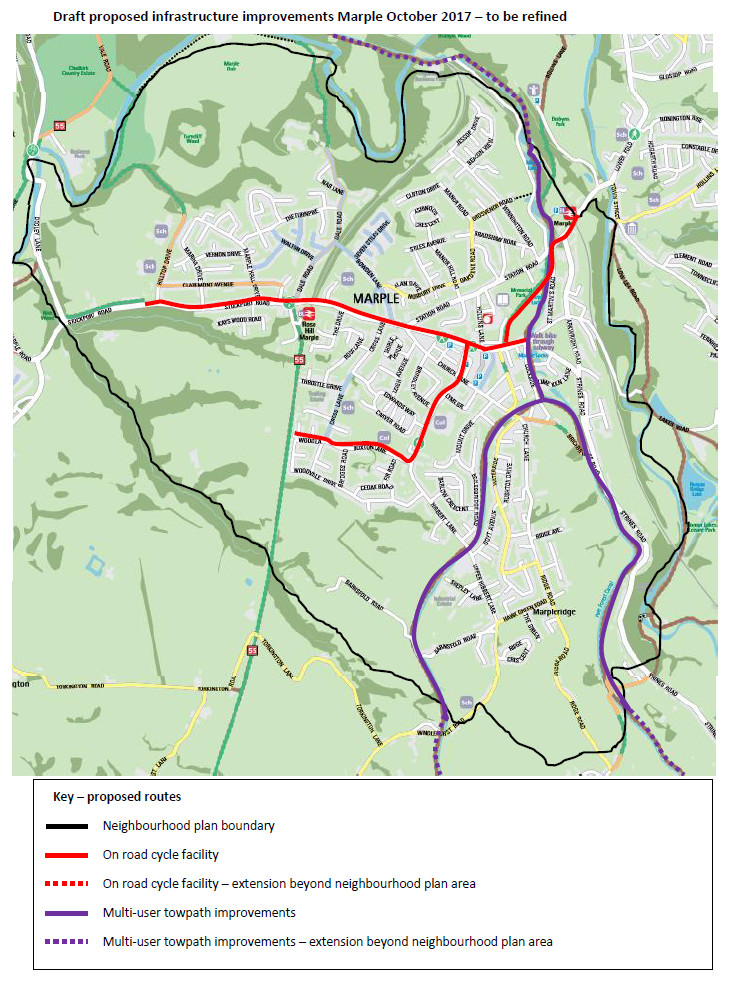
- Draft proposed cycle network (attached)
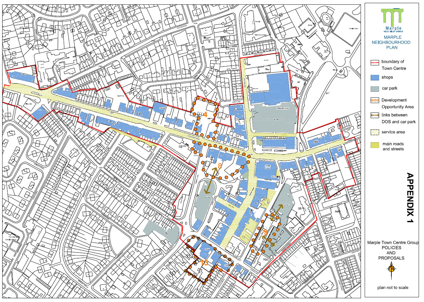
- Initial thoughts on town centre (attached) - this is a working draft, so may not appear in the formal consultation version of the plan and will certainly be modified
We will also use maps from a Cheshire Wildlife Study showing ancient woodlands, habitat corridors, etc. This is a large file, so let me know if you would like to see this.
It is also proposed to produce maps showing:
- Housing proposals
- Area of development opportunity near the stations and The Hollins
As a group of volunteers our ability to produce mapping is limited, and our local authority have been less than helpful. If the person requesting the mapping has any skills in this direction, then we would be very interested in any help that they could give the Neighbourhood Plan process.
Posted on behalf of Marple Neighbourhood Forum.
PDF Links:
Neighbourhood Plan BoundaryDraft proposed cycle networkInitial thoughts on town centreImages:


